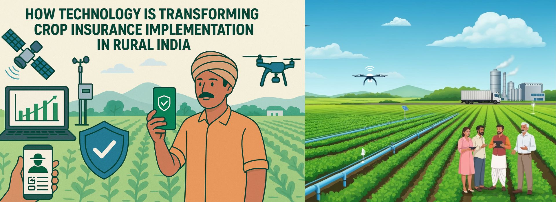
How Technology is Transforming Crop Insurance Implementation in Rural India
October 9, 2025How Technology is Transforming
Crop Insurance Implementation in Rural India
Agriculture in India is deeply
exposed to risk: unpredictable weather (droughts, floods, hail), pests, and
market shocks. Crop insurance—especially schemes like Pradhan Mantri Fasal
Bima Yojana (PMFBY) and the Restructured Weather-Based Crop Insurance
Scheme (RWBCIS)—aim to protect farmers from these risks. But traditional
implementation has had many challenges: delays, inefficient assessment, lack of
trust, poor transparency.
Technology is now being infused
into crop insurance implementation, helping to overcome many of those
challenges—improving speed, accuracy, and farmer satisfaction, especially in
rural areas. Below are the key ways this transformation is happening, along
with benefits, challenges, and what to expect in the near future.
Key Technological Innovations
- YES-TECH (Yield Estimation System Using
Technology)
- YES-TECH uses remote sensing (satellite imagery,
drones, UAVs), machine learning / AI, and other geospatial tools to
estimate yield and crop losses. Insurance Business America+4owsa.in+4The
Hindu Business Line+4
- Under YES-TECH, technology-based yield estimates
are given a minimum weight (e.g. 30%) in crop yield assessments, which
helps reduce reliance on slower, error-prone methods like Crop Cutting
Experiments (CCEs). mint+3owsa.in+3The Hindu Business Line+3
- WINDS & Hyper-Local Weather Monitoring
- The government is establishing a denser network of
Automatic Weather Stations (AWS) at the block level and Automatic
Rain Gauges (ARGs) at Gram Panchayat levels to capture hyper-local
(fine-grained) weather data. Insurance Business America+2Ruralvoice+2
- This helps detect localized weather events (e.g.,
hail, excess rain) more accurately, which are critical for quickly
assessing damage and triggering claims. Moneycontrol+1
- E-Panchanama / Mobile / App-Based Reporting of
Crop Damage
- In places like Nagpur, Maharashtra, e-Panchanama
has been trialed: village officers (talathis) file crop damage reports
using mobile apps with features like GPS tagging, photograph uploads,
dropdown menus etc. This speeds up damage assessment and adds transparency
in rural areas. The Times of India
- Reduces paperwork, reduces dependence on manual
field visits, helps track and verify losses more systematically.
- Drones, Remote Sensing & AI
- Drones are being used to take high-resolution
imagery of fields for damage detection, for assessing crop health, and to
supplement satellite imagery. Cropin+3The Economic Times+3The Hindu
Business Line+3
- They help where satellites are not enough (e.g.
cloud cover, fine resolution needed). Combined with AI / analytics, these
tools help detect stress, disease, or damage early, enabling more
accurate yield estimation. The Hindu Business Line+2Cropin+2
- Automated / Digital Claim Settlement: DigiClaim
etc.
- Under PMFBY, modules like DigiClaim have
been introduced to enable automated claim settlement, reducing delays and
moving towards timely payments to farmers.
- Digital workflows reduce friction, reduce the
chances of misplacement of documents, help in tracking claims better.
- Single-Window Portals, Helplines, and Platforms
- E.g., Sarathi Portal / Sandbox framework
under PMFBY: aiming to provide a simplified, digitised journey for
farmers where they can view, purchase, and access insurance products via
a single platform. ETBFSI.com
- Learning Management Systems (LMS) for training
farmers, helplines like Krishi Rakshak for queries. These also help in
raising awareness and increasing adoption. ETBFSI.com
- Fund for Innovation & Technology (FIAT)
- The government has allocated a dedicated fund (₹
824.77 Crore) to support technological initiatives under PMFBY and RWBCIS
(like YES-TECH, WINDS etc.). PM India+1
- This encourages R&D, piloting of new methods,
deeper adoption across states.
Benefits for Rural Areas
- Faster Claim Settlement / Relief: Projects
like e-Panchanama, DigiClaim etc. help reduce the time between damage and
compensation. This is especially helpful in rural settings where delays
have big consequences.
- More Transparent / Trustworthy System:
Visual proof via photos/drones, GPS tagging, remote sensing reduces
opacity and chances of fraud or error.
- Reduced Costs: Manual field surveys are
labour-intensive and slow; technology can help optimize that resource
usage, focusing manual work where essential rather than everywhere.
- Better Risk Assessment: With better data
(weather, satellite, drone, etc.), insurers and the government can more
accurately model risk, which helps in setting fairer premiums, designing
better insurance products.
- Improved Coverage & Inclusion: Easier
enrollment, easier reporting may encourage more small and marginal farmers
to participate who earlier avoided due to bureaucratic or procedural
hurdles.
Challenges & Risks
While the benefits are promising,
there are still hurdles, especially in rural implementation:
- Data Quality, Timeliness, Ground-Truthing:
Remote sensing and drones may show anomalies (fields may look “green” but
waterlogged etc.). Ground verification is still needed. Example: a
drone-based damage assessment plan in Marathwada was shelved after trials
because imagery couldn’t reliably distinguish damage vs mere waterlogging.
The Times of India
- Connectivity and Infrastructure: Rural areas
often have patchy internet, power, or device availability. If apps or
sensors cannot reliably send/receive data, delays or errors creep in.
- Cost & Scaling: Initial cost of setting
up weather stations, drone deployment, sensors etc. is high. Scaling them
to cover the vast and fragmented agricultural lands in India (many small
holdings) is non-trivial.
- Awareness & Training: Farmers, field
officers, panchayat staff need to understand new tools, how to use apps,
how to interpret reports. Without this, technology may be under-utilised
or misused.
- Institutional & Regulatory Alignment:
Coordination among multiple agencies (Insurance companies, state govt,
meteorological dept, agriculture dept, remote sensing agencies etc.) is
required. Also data privacy, standards, roles and responsibilities need
clear definition (e.g. who owns the remote sensing data, who is liable for
errors, etc.).
- Dependency on Technology Failures: Clouds,
sensor failures, model bias etc. If tech tools fail, or have missing data,
wrong models, that can cause misestimation and harm trust.
Recent Examples / Case Studies
- Nagpur (Maharashtra) – E-Panchanama:
Successful trial of e-Panchanama for damage reporting via app: village
talathis filed over 86,000 reports with photo/GPS etc. It is being
considered for statewide roll-out. The Times of India
- Bengal Tea Plantations – Weather-Based Insurance:
The government has extended weather-based insurance coverage to plantation
crops like tea in West Bengal (and others). This shows expansion beyond
traditional food crops. The Times of India
- YES-TECH Implementation across several
states: The yield estimation using technology being piloted / rolled out
in many states (e.g., Madhya Pradesh etc.). The Hindu Business Line+3owsa.in+3Ruralvoice+3
What’s Next / What Needs to Be
Done
To ensure that technology makes
crop insurance truly effective in rural India, here are some recommendations
and future paths:
- Scale up weather station / sensor networks
so that hyper-local weather data is available everywhere — this will help
for early warning, claim triggers, localised risk pricing.
- Strengthen ground verification & combined
models: Use hybrid models combining remote sensing, drone imagery, and
spot field verification to ensure accuracy, mitigate false
positives/negatives.
- Ensure farmer participation / feedback loops:
Let farmers see and understand how assessments are done; provide
mechanisms for grievance redressal when tech‐based estimates are disputed.
- Capacity building at grassroots for using
mobile apps, understanding yield estimations, data literacy so that
adoption is smooth.
- Standardization and transparency of models:
Clear published guidelines of how yields/damage will be calculated, what
weightage is given to which data source, so everyone (farmers / officials
/ insurers) can trust the process.
- Focus on affordability: Subsidies, cost
sharing, making insurance accessible for small/marginal farmers; using
community-level cooperatives or institutions to reduce costs of drone
usage or sensor deployments.
- Policy & Institutional Support: Ensure
states align with the central guidelines (YES-TECH, WINDS, FIAT etc.), and
adequate funds and technical partners are available. Also regulatory
support for data usage, drone operation etc.
- Leveraging Emerging Tech: AI/ML, federated
learning (so that privacy is preserved), better sensors (soil moisture,
microclimate), remote sensing advances, use of satellites with better
resolution, perhaps use of blockchain for claim documentation/tracing.
Conclusion
Technological integration in crop
insurance is not just a “nice to have” — it’s becoming essential if India is to
deliver timely, fair protection to its farmers, especially in more remote and
vulnerable rural areas. Innovations like YES-TECH, drone & satellite
imagery, mobile reporting, weather station networks, and digital claim
platforms are already changing how the system works.
Yes, challenges remain (data,
costs, logistics, trust), but with continued policy support, capacity building,
and stakeholder cooperation, technology can significantly reduce risk for rural
farmers, increase uptake of insurance, and make agricultural livelihoods more
resilient.
At krishibazaar.in, you
can find and buy various agricultural products. For agricultural guidance on
selecting the most suitable products for your crops, please contact or WhatsApp
at +917887880887.


Guest reviews
No reviews found for this Blog